|
||
Since 1988 I have been a weather watcher from my home in Galena Forest and now Montreux located in the Carson Range of the Sierra Nevada mountains near Reno, Nevada. Our current location is about 700 ft. lower in elevation but in the same general area. My interest in the weather dates back to my childhood when I am told I would pretend to be the TV weatherman. My years of flying as an instrument rated pilot increased my interest since many times correct weather interpretation kept my family and me alive. As an avid skier I am always interested in the storms that produce the heaven like powder snow we love to play in. Over the years I found there are lots of folks interested in the same thing. Long range forecasting is my main interest, and it seems that local weather people are very hesitant to forecast very long range (more than five days). Hence, I decided to begin sending an e-mail to my friends who shared the common interest or just wanted to plan sick days off around big snow dumps. Updates are posted every few days as weather predictions change during the active weather months. From June through September updates are seldom. Daily updates are found on our weather station site noted below. - Randy York ________________________________________________________________________________________________________________________________________________________________________ |
||
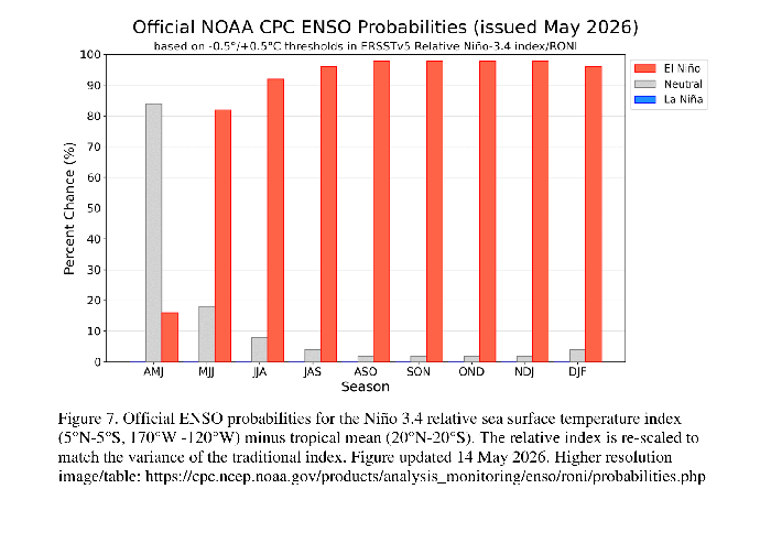
July 10, 2026 Summer is in full swing with seanonal temperatures in the mid 90's in Reno. Monsoon moisture heading our way next week. We will take a break for the Summer unless there occurs some news that warrants a Blog post. We will keep an eye on the pending El Nino forecasted for the Fall and Winter. Below is a monthly update on the strength and probability of ENSO. I have never seen this before, the entire chart in red with a El Nino forecasted all the way into Spring of 2027.
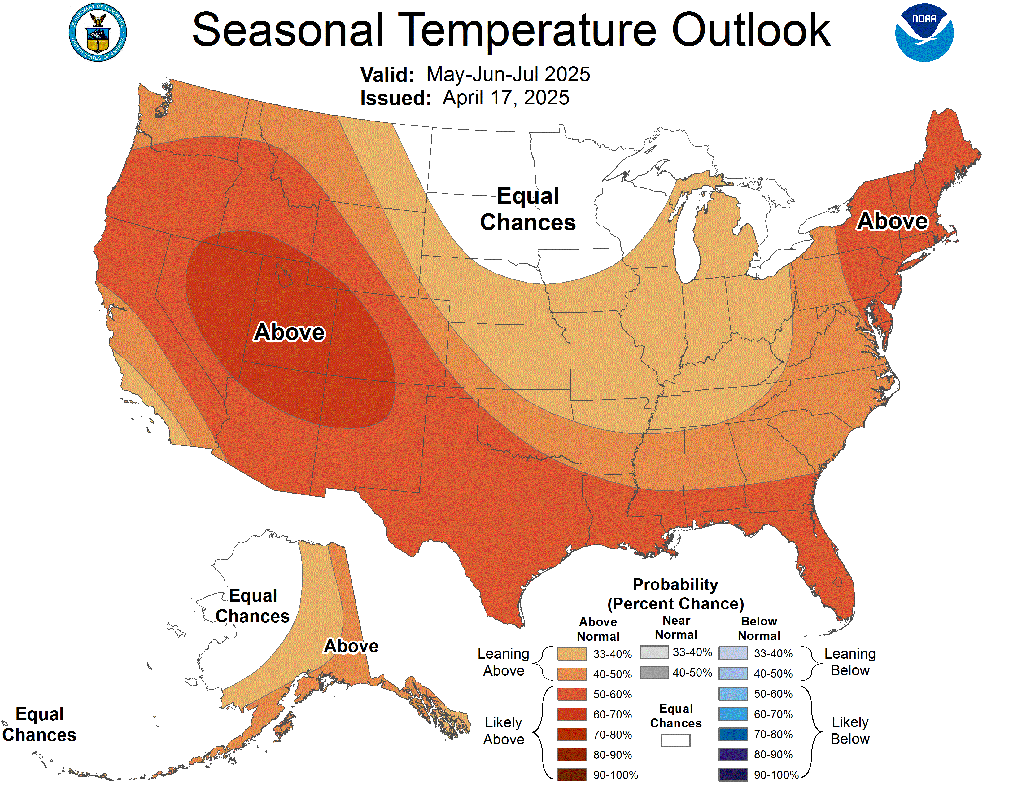
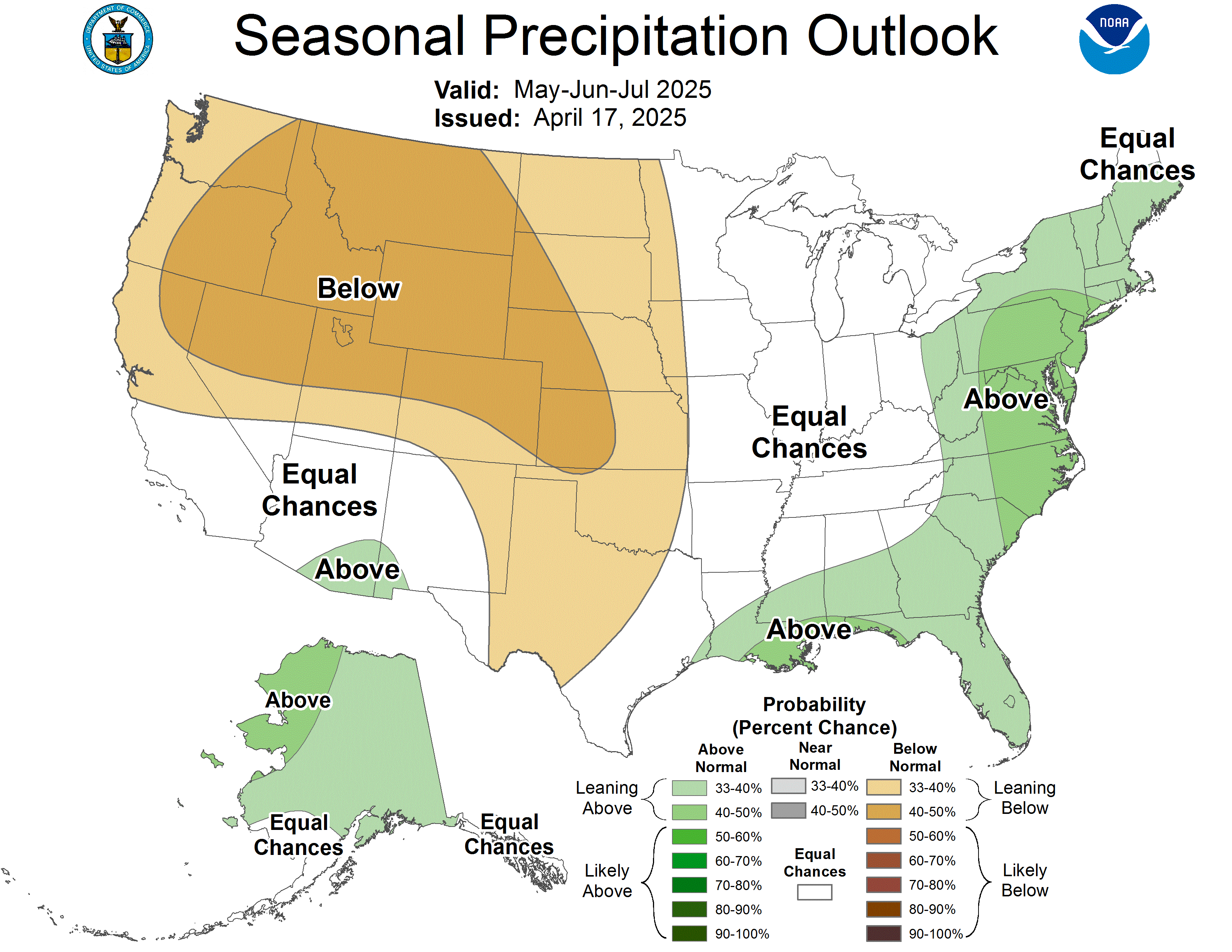
Below you will find the three month outlook which we update monthly. Check our daily report and the National Weather Service for updates. Our daily report on our weather station site, looks 3 to 5 days ahead. Please comment, if you like, on our forecasts, your own observations, or anything else. Our email link is posted below.
Visit our weather station site for Daily Forecasts at www.renowx.net |
||
Contact us by sending your email to info@renowx.net |